Download
Aviation Weather with Decoder: Your All-in-One Aviation Weather Solution
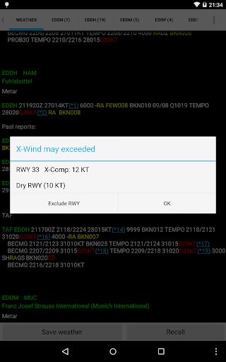
This powerful weather app delivers precise, real-time meteorological data, simplifying flight planning and enhancing situational awareness. Access multiple weather reports concurrently for effortless multi-location monitoring. Review past weather data to identify trends and patterns. The app conveniently stores reports and NOTAMs, keeping all vital information readily available.
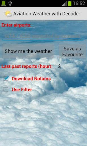
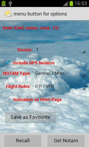
Easily input airports using ICAO/IATA codes or airport names, and seamlessly visualize locations on integrated Google Maps. Personalize your experience by adjusting text color, size, and font for optimal readability. Helpful tools like a METAR decoder, VOLMET access, and a crosswind calculator are included for added convenience.
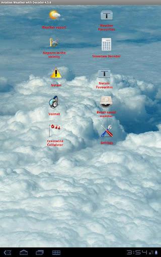
Key Features:
- Simultaneous Multi-Location Reports: Track weather conditions across multiple locations at once.
- Historical Weather Data: Analyze past weather reports to understand patterns and predict future conditions.
- Centralized Report & NOTAM Storage: Securely store and quickly retrieve crucial weather information.
- Intuitive Airport Input: Use ICAO/IATA codes or airport names for easy report retrieval.
- Google Maps Integration: Visually locate airports on Google Maps for efficient planning.
- Customizable Interface: Tailor the app's appearance to your preferences with adjustable text settings.
- Essential Aviation Tools: Utilize integrated METAR decoding, VOLMET access, and a crosswind calculator.
In Summary:
Aviation Weather with Decoder provides a comprehensive platform for accessing and interpreting NOAA METAR and TAF reports. Its user-friendly design, combined with powerful features like multi-report viewing, historical data access, and Google Maps integration, makes it an invaluable tool for pilots and aviation professionals. Download today and make informed decisions based on the most accurate weather information.